“In 1819, when Alabama entered the Union, its leaders designed a great seal that featured the state’s waterways. In adopting this symbol they affirmed their belief that the future of Alabama lay with its rivers. It did, and it still does.”
Harvey Jackson III, Rivers of History

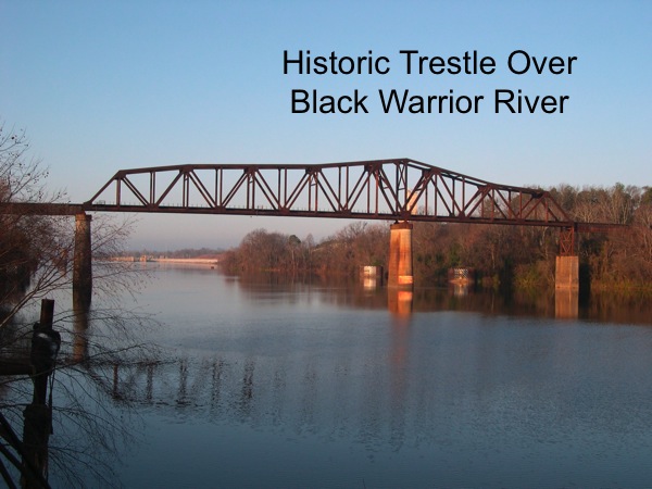
Historic Trestle over the Black Warrior River
This urban route encircles approximately 12 miles along the Black Warrior River. Three bridges along the route offer breathtaking views of the river and its riverbanks. The route spotlights the boundless natural scenic beauty of the Black Warrior River and exhibits historic ruins, structures and markers including the site of the Alabama State Capitol from 1826 until 1847. Bicycle and pedestrian trails, parks, picnic facilities, fishing piers, boat landings, historic markers, and restaurants as well as sites for new development align the route. Bordering the route are the historic downtown areas of Tuscaloosa and Northport and facilities of academic and athletic renown including the University of Alabama and Stillman College. Enlightening sites listed on the National Register of Historic Places are in abundance nearby and along the route.
The Tuscaloosa Amphitheatre with seating capacity of over 7,400 serves as a gathering place for many events and is conveniently located along the byway. Just a short drive away, the Moundville Archaeological Park is within 15 miles; Lake Lurleen State Park is within 10 miles; the Sipsey River Swamp, one of Alabama’s Natural Wonders and one of the state’s largest wetlands, is within 10 miles as well as renowned museums and an array of cultural opportunities.
Rich in history, Tuscaloosa was discovered in 1540 by troops of the Spanish explorer Hernando DeSoto. The area was originally home to Native Americans. The name Tuscaloosa is derived from Chief Tuskaloosa which, literally translated, means “Black Warrior.” Long before white people settled, there was an Indian village near the present site of Tuscaloosa. The first white settlers came to the area around 1816 and Tuscaloosa and Northport were settled around the Black Warrior River. Tuscaloosa was incorporated in 1819 and Northport was incorporated in 1871. A ferry was established soon after the first settlers arrived and the first bridge was built in 1835 to connect Tuscaloosa to the north and west of the river. Large shoals made it impossible to navigate to the east. First the ferry and then the bridge made Tuscaloosa the head of navigation for downstream travel to Mobile.
Today, the Black Warrior remains a very important river to the area and it is an essential link in Alabama’s inland waterway system. The Black Warrior Basin drains the largest coalfield in Alabama and the Black Warrior River became the primary artery for its export. For this reason, permanent modification of the Black Warrior River Channel was envisioned and in 1886, the U.S. Army and their Board of Engineers began discussing a system of five locks and dams on a fifteen mile segment. The construction began in 1888 in Tuscaloosa. The Black Warrior was the first river in the state to receive such navigational improvements. New locks and dams that ensure year-round navigation for barge and pleasure boat traffic have replaced the original ones and frequent dredging is required to maintain the navigational depth of nine feet.
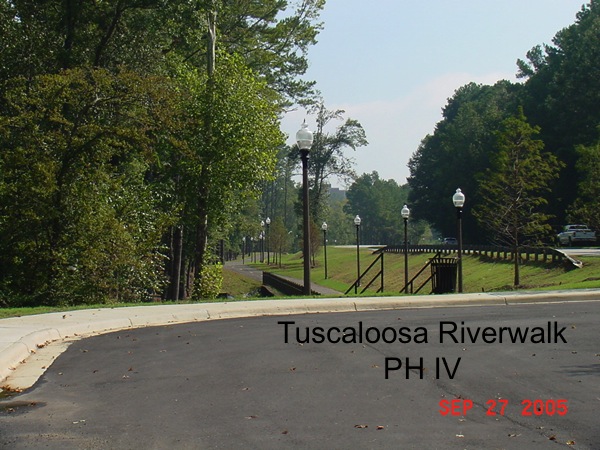
Unquestionably, the Black Warrior River has been central to the history and economy of the area and it is central to future development. Community leaders are working diligently to showcase this inexhaustible natural asset. The Black Warrior River Scenic Byway includes twelve miles of existing roadway which boarders the evolving Tuscaloosa Riverwalk and the Northport Riverwalk. Master Plans for Riverfront development have been adopted by the City of Tuscaloosa and the City of Northport. Riverfront development activity or plans include a 7,500 seat amphitheatre, convention center and hotels, a River Market that will be home to the Tuscaloosa Tourism and Sports Commission, a water trail, marinas and boat docks, restaurants, retail, parks, pedestrian and bicycle trails, green spaces, picnic areas, pavilions, scenic overlooks, mixed use developments, office parks, residential developments, and office complexes and museums.
In addition to the historic downtown areas of Tuscaloosa and Northport, the route includes the historic Queen City Pool and Bathhouse complex which is listed on the National Register of Historic Places. The bathhouse was preserved and renovated and is home to the Mildred Westervelt Warner Transportation Museum. To date, three miles of the thirteen mile Tuscaloosa Riverwalk pedestrian and bicycle trail have been constructed or is underway and the City of Northport has completed two miles of Riverwalk pedestrian and bicycle trails.
Gateways to the Black Warrior River Scenic Byway include Interstate 59/20 at Exits 71 and 73, U.S. Highway 82 East and West, U.S. Highway 43, and U.S. Highway 69.